
Just had to post this again!
via Mappy Groundhog Day!
Just had to post this again!
via Mappy Groundhog Day!
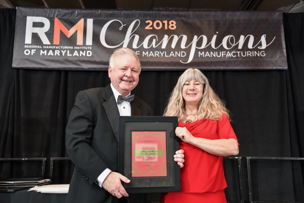
Holly Heintz Budd, President/CEO of Williams & Heintz Map Corporation receives Energy and Sustainability Award from RMI President, Mike Galiazzo.
Williams & Heintz Map Corporation, a specialist in map printing, production, and folding is pleased to announce that they have been named a 2018 Champion of Maryland Manufacturing, by the Regional Manufacturing Institute of Maryland, (RMI).
Williams & Heintz Map received an award for Energy and Sustainability. Champions in this category are manufacturing companies or individuals that have or who have, significantly increased energy savings or helped to reduce carbon footprint within manufacturing facilities.
“It is very rewarding that Williams & Heintz Map is counted as a champion at this event with so many accomplished Maryland manufacturers,” said Holly Heintz Budd, President and CEO of Williams & Heintz Map Corporation. “We are a great team at Williams & Heintz Map, all of us work hard to make the company what it is today.”
RMI received 280 champion nominations from every county in Maryland and Baltimore City in the following nomination categories: Community Engagement, Emerging Leaders, Energy & Sustainability, Growth & Productivity, International Business, Manufacturing Technology (Industry 4.0), STEM Student Advocate and Talent Attraction. The RMI Nominations Committee chose the top 5 Champions who best exemplify these important categories that promote the true image of Maryland Manufacturing, highlighting the creativity and spirit embodied in today’s Maryland manufacturing ecosystem.
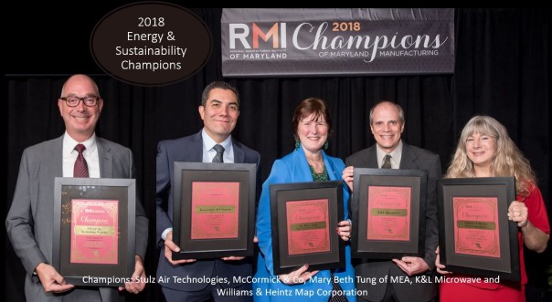
2018 Energy and Sustainability Champions: Stulz Air Technologies, McCormick & Co, Mary Beth Tung of MEA, K&L Microwave and Williams & Heintz Map Corporation
Founded in 1990, the Regional Manufacturing Institute (RMI), a non-profit association, was created for manufacturers in the Baltimore Metropolitan area. Today, RMI of Maryland represents the interests of manufacturers statewide – providing programs, services, and advocacy.
The event, recognizing the top Champions of Maryland Manufacturing, highlights extraordinary successes and celebrates our community spirit to promote a positive image of manufacturing in Maryland. Telling the stories of those championing manufacturing helps others learn about the vibrancy of Maryland manufacturing today.
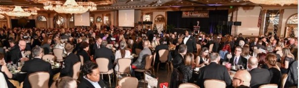
2018 Champions of Maryland Manufacturing Gala drew over 600 stakeholders.
Williams & Heintz Map Corporation is ISO 14001 certified and a Maryland Green Registry Member which uses green materials and sustainable environmental practices that combine sound business principles with environmental stewardship.
Williams & Heintz Map Corporation has been printing maps for entrepreneurs, government agencies, and map publishers since 1921. They combine industry leading knowledge and customer service with the highest quality pre-press, printing, and folding.
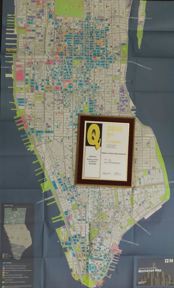
Williams & Heintz Map Corporation won the 2018 Q Award from the Printing and Graphics Association Mid-Atlantic, (PGAMA) for printing of Newmark Grubb Knight Frank’s Manhattan Map.
Williams & Heintz Map Corporation is pleased to announce that we won the 2018 Excellence in Print Awards for the Best in Category for Map Printing.
The Q Award from the Printing and Graphics Association Mid-Atlantic, (PGAMA), is for the printing of Newmark Grubb Knight Frank‘s Manhattan Map.
The Manhattan Map Is printed on Paper Tiger. is a durable printing substrate with a polyester core and and paper fiber on the outside. This gives it the appearance and feel of paper, with tear proof durability of plastic.
The Manhattan Map was printed with 4 color process. It is 35 by 58.5 inches and folds to 8.75 by6.5 inches.
As always, we are grateful to our customers who come to us for their quality map printing.
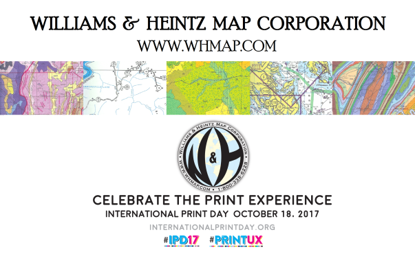
October 18, 2017 is International Print Day. I am happy to celebrate my love of print with you! This year’s theme, is the User Experience.
The spatial awareness you get from the big picture of a large printed map, combined with the ability to crunch down into the details with your computer or mobile phone, when used together, gives you the best of both worlds for the best User Experience!
Here’s a quick video with just a few of the maps we have printed in the last few months. Enjoy. #IPD17 #PrintUX
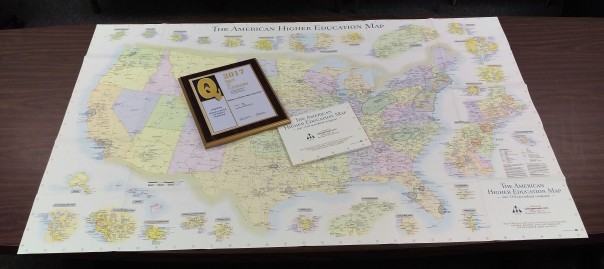
Williams & Heintz Map won a 2017 Q Award from the Printing and Graphics Association Mid-Atlantic, (PGAMA) for printing Tom Hedberg’s College Map. The American Higher Education Map shows the location of every university and college in the country.
I love reading about maps in the news, especially printed maps. So, I was pleased to see this article in the Star Tribune about Tom Hedberg: Who needs GPS and Google? Minneapolis map publisher is ‘master of cartography’.
s article starts out with a great example of Tom Hedberg’s creative and useful maps.
Sure, your phone is a great navigation tool.
But can it show you all of the dog-friendly breweries in the Twin Cities? The location, times and what’s playing for the Music & Movies program in Minneapolis parks? Or display at a glance where every college, minor-league ballpark or airport in the country is located?
You can have that information at your fingertips thanks to a Minneapolis man named Tom Hedberg.
At a time when we increasingly rely on GPS to tell us our place in the world, Hedberg is still doing navigation the old-fashioned way — making maps, not apps.Maps, as you may recall, are big pieces of paper, often folded in a complicated accordion pattern, that everyone used to keep in the glove boxes of their car.
Earlier this year, Williams & Heintz Map won a Q Award from the Printing and Graphics Association Mid-Atlantic, (PGAMA) for printing one of Hedberg Maps. The American Higher Education Map shows the location of every university and college in the country.
The Star Tribune article includes a quote from Sue Luse, an Eagan-based consultant to students planning college applications.
“I haven’t found anything else like it online, I give them to every single one of my clients.”
Chin
Thank you Tom Hedberg, for choosing Williams & Heintz to print your maps so that we can win prizes! Definitely read the article if you are into maps. It go into detail about the changing business of maps, as GPS and google grab up market share. Like me,
Hedberg is optimistic. He likens his maps to LP records, saying they won’t completely disappear because they’ll always appeal to a niche audience.
That’s partly because paper maps won’t break or run out of batteries. They can unfold to a view of the world more expansive than the screen of even the largest cellphone.
“Paper is a really good hard-copy backup,” said Andy Mickel, a Minneapolis software developer who buys Hedberg paper maps and atlases. “Sometimes it’s good to stare at the big picture.”
Williams & Heintz Map Corporation announced it was removing the seemingly superfluous “s” from its name, thereby becoming “William Heintz Map”. It admitted that it had long been fighting a “losing battle” against people who didn’t understand why the extra ‘s’ was there, and it had finally decided to “give up”. The ampersand was also removed because so many people thought that the company was just named after the past President, William Heintz.
The map printer acquired its name when they moved to 8119 Central Ave. in Capitol Heights, Maryland and incorporated on July 1, 1959 as Williams & Heintz Map Corporation. However, evidence suggested that Mr Williams left the business sometime in the 1940s. The current owners if this family business are are 4th generation and never met Mr. Williams.
Much of this article was shamelessly copied from an earlier article.
NOAA privatized printing of paper nautical charts in 2014 and, in the ensuing years, focused on modernizing chart compilation and production. Those recent changes allow us to update both paper and digital charts on a weekly basis. However, mariners still have had to deal with a cumbersome Local Notice to Mariners process to get important (or less than important) updates to the charts that they already own. Coast Survey is now making life a little easier for chart users.
Prior to 2014, when the government printed paper charts, it was easy to decide when to purchase a chart: when NOAA issued a “new edition.” Until that new edition came out, users just penciled in the updates as provided in the Local Notice to Mariners. Now, however, we are updating the actual charts before issuing new editions, on a weekly basis. Obtaining the…
View original post 635 more words
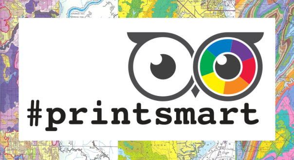
Use #PrintSmart and #IPD16 on social media to learn about all the great things that you can do with print on International Print Day, October, 19, 2016
This year the International Print Day theme is Print Smart. #PrintSmart is all about sharing education and resources for learning about how wonderfully relevant print is in the digital age.
At Williams & Heintz Map Corporation, we would like to share some Map Printing Tips. Our map printing tips were originally published as a series of posts when we first started our blog. We answer frequently asked questions about Map Pre-Press, Map Printing, and Map Folding.
How do I choose the paper for my map?
How do I decide on the size of my map?
How do I choose ink colors for my map?
What do I need to consider about Map folding and finishing?
Is it important to ask questions and communicate with my printer?
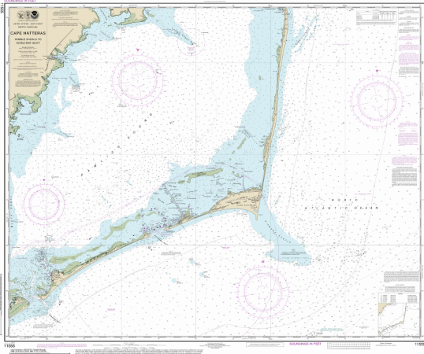
Williams & Heintz Map Corporation Print on Demand (POD) nautical charts are produced under the authority of the National Ocean Service, National Oceanic and Atmospheric Administration (NOAA). NOAA is the national hydrographic office for the United States of America. The data from which these POD chart are produced is certified by NOAA for navigation use. POD charts meet the requirements for the mandatory carriage of nautical charts established by the U.S. Coast Guard and published in Titles 33 and 46, Code of Federal Regulations, including the requirements for updating.
24 lb. JCP E-20 High Wet Strength Map Paper, a white paper with a lithographic finish that is made to be used out in the elements. This economical paper is fully functional even when wet.
36 lb. JCP E-50 Chart Paper, genuine 50% cotton nautical chart paper, the same kind of paper as the lithographically printed charts that mariners are accustomed to.
NOAA has authorized Williams & Heintz Map Corporation to sell NOAA’s paper nautical charts that are printed when the customer orders them, or “on demand.” The information on the charts is still maintained by NOAA, and the charts are corrected with Notices to Mariners up to the week of purchase.
We print the charts at Super Fine – 1440 x 720 DPI, up to 64 inches wide, on a G7 calibrated wide-format printer.
Williams & Heintz uses no toxic solvent inks or dangerous UV processes.
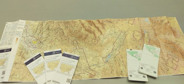
Williams & Heintz Map is excited to announce that we are now an FAA Approved Print Provider of VFR and EnRoute Charts. We are looking forward to working with all of FAA’s current Chart Agents.
The Federal Aviation Administration (FAA), Aeronautical Information Services (AJV-5), is transitioning to an Available on Demand (AOD) model for all aeronautical charts and related products. In other words, the printing and distribution of all paper products will be met from FAA Approved Print Providers in the near future.
More information about Williams & Heintz Map Corp. becoming the first FAA Approved Print Provider will be coming soon.

